The Modern Grand Tour walking & hiking trail Frontpage
Welcome
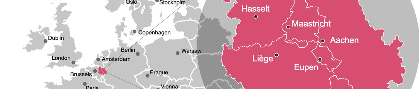
The Modern Grand Tour long-distance trail is as you can see above situated in the heart of the Meuse-Rhine Euregion, between the cities Maastricht (NL), Genk (BE), Hasselt (BE), Liège (BE), Eupen (BE) and Aix-La-Chapelle (DE).
With its 3 languages and 5 partner regions, the Meuse-Rhine Euregion is the most versatile and complex Euregion, but these regions are not at all as different as it might seem at first glance. Of course there are state and language borders, but historically, culturally and economically they are more related, as you will discover.
Depending on when you walk, each season will bring something different: in spring you’ll seem lambs in the fields; in late summer, the meadows blooms with heather and gorse; autumn is a prime time to see mushrooms and migrating birds; and in winter, there’s nothing like walking in snow if you are lucky.
Inhabitants of the Meuse-Rhine Euregion live the “European idea” as they benefit from all advantages by living, working and shopping in different countries. The open borders create opportunities for the regional population as well as institutions and services. This leads to new partnerships and the exchange of knowledge and best-practices. Today the inhabitants on both sides of the borders live and work in good terms with the neighbors, so that it appears as if the border is just one line on the map, which has lost meaning in everyday life.
The Eifel, the Ardennes and the Meuse-Rhine valley are rich in history, natural beauty and views.
Maastricht, Liège and Aix-La-Chapelle belong to the monumental cities of Europe, but are barely visited. Although if you walk here you sometimes get the feeling as if you are in regions of Italy and France.
The need for integration is nowhere better understood than in the Meuse-Rhine Euregion, it is precisely here that the Romanesque and Germanic people and languages meet. If this dividing line is accentuated by boundary barriers, tensions and extreme contrasts can arise. Many inhabitants in the Meuse-Rhine Euregion have realized if these boundary barriers completely disappear, that they have common interests and a lot can be learned from each other.
At the end much more can be achieved through cooperation than alone.
The Meuse-Rhine Euregion is the successful proof of European integration. They are the heart of Charlemagne’s ancient empire, which originated in the same desire.
Start walking & hiking this long-distance trail and a year from now, you will wish you had started today.
Overview map and stats of the long distance trail :
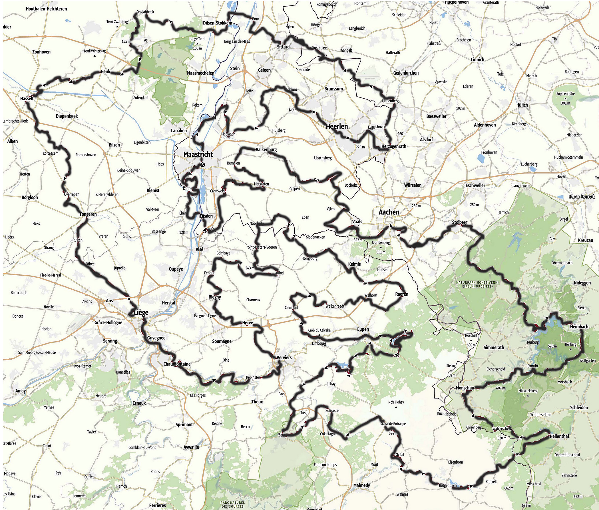
| Total distance: | 919 kilometers |
| Total ascent: | 12.473 meters |
| Highest point: | 699 meters at Signal de Botrange (BE) |
| Lowest point: | 23 meters at the banks of the river Meuse (NL) |
| Elevation map: | Stages 1. till 44. |
| Long-distance trail: | In 44 stages or in 4 sections |
| Average stage distance: | 20,9 kilometers |
| Natural trail, path, gravel and dirt road: | 82,2% |
| Asphalt and road: | 17,8% |
| UNESCO heritage sites: | 12. |
Public transport:
Europe’s industrial heritage: