A long-distance walking & hiking trail in the Euregio Meuse-Rhine
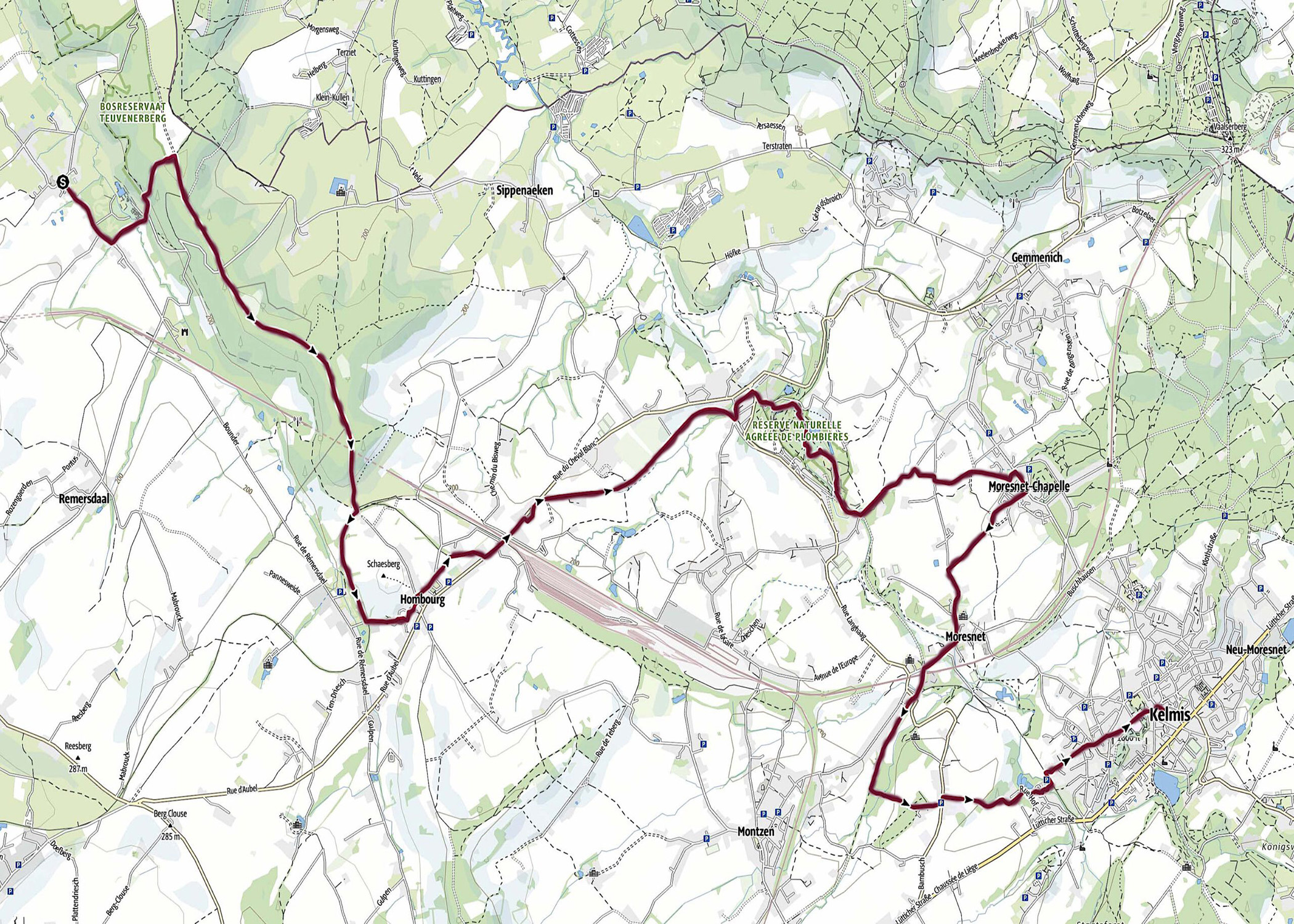
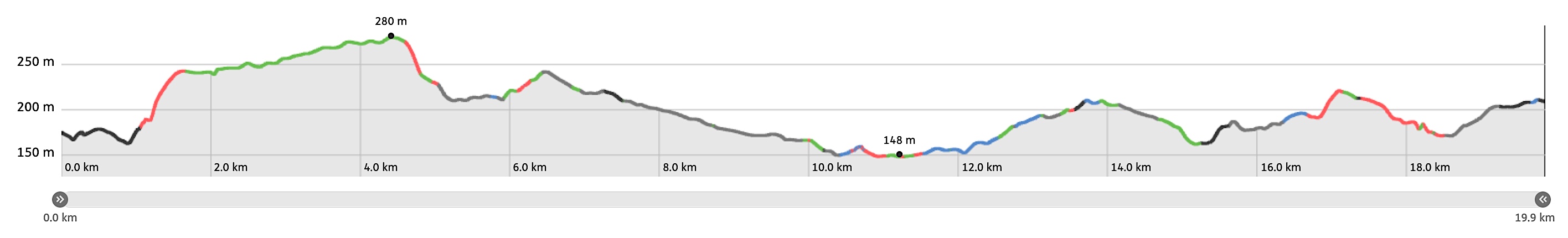
Stage 19. Teuven (BE) to Calamine / Kelmis (BE)
Stage 19. Teuven (BE) to Calamine / Kelmis (BE)
Teuven is a church village in the Belgian province of Limburg in the Tongeren district. When Belgium became independent, geographer Philippe Vandermaelen made an inventory of 50 houses in the center of this village, a church, a town hall, a mill, two castles, a brewery and a primary school, read more…
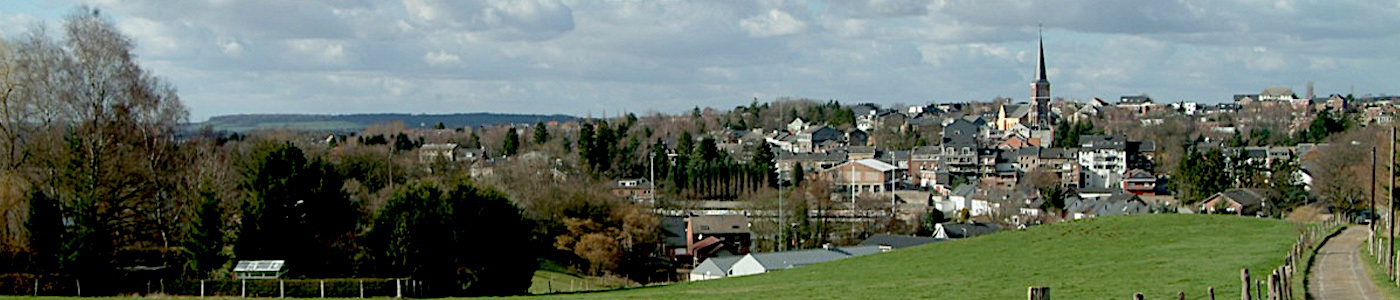
Kelmis (La Calamine) is located at the frontier between Belgium, Germany, and the Netherlands. It’s the northernmost town in the German-speaking community of Belgium and is grown around the Altenberg zinc mine, read more…
Gpx tracks can be uploaded to many devices, so know the direction to follow or your position.
KML files can be uploaded in Google Earth. As result you get a detailed satellite view. You can even follow a videotour, which is a linear walk-through the stage.
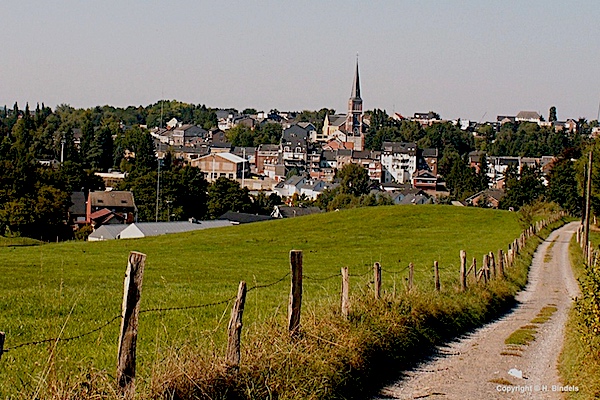
Some highlights:
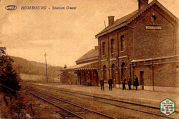
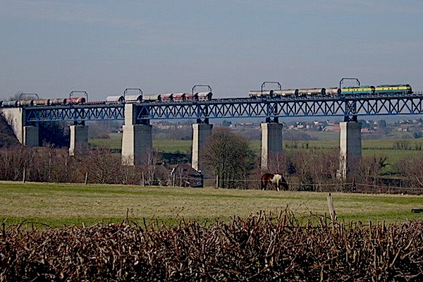
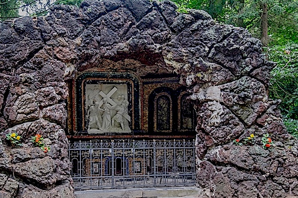
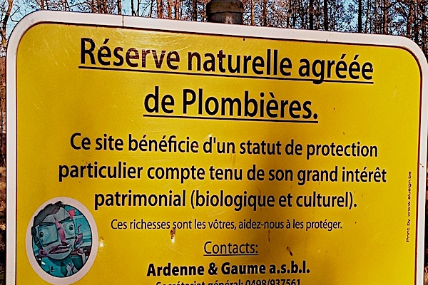
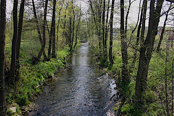
Ancient railroad station HombourgRailroad bridge MoresnetMoresnet-ChapelleNature reserve PlombièresStream la GeueleView on Calamine/Kelmis
Neutral Moresnet, officially. The undivided area of Moresnet was a neutral area from 1816 to 1920 of barely 344 hectares, which belonged to both the the Netherlands and to Prussia. The area, in the shape of an obtuse triangle was south of the Vaalserberg and extended to the main road from Aachen to Liège,read more…
Specific local info:
Roman history
Around 19 BC. the Romans from Italy, led by Julius Caesar invaded the Euregio Meuse-Rhine and remained until 450 AD.
For almost five centuries, the Euregio Meuse-Rhine was part of the Roman Empire. While the Roman emperors ruled here, cities such as:
- Maastricht (Mosae Trajectum), - Heerlen (Coriovallum), - Aachen (Aquis Granni),- Tongeren (Atuatuca Tungrorum) - Liège (Leodicum) flourished into busy trading centers. Also due to an important Roman main road: the Via Belgica, that ran straight through Zuid-Limburg from Boulogne sur Mer (France) to Köln (Germany).
In the early Middle Ages, Maastricht consisted of a number of residential areas, churches, a toll office and a fortified manor court on the Vrijthof. This palatinate formed the royal estate. It is almost certain that Charlemagne visited this palace when he was on his way to Aachen. In German: Karl der Grosse; In French and English: Charlemagne; In Latin: Carolus Magnus or Karolus Magnus He probably lived from April 2, 747 or 748 - Aachen, January 28, 814 He came from the family of the Carolingians, Was king of the Franks from 9 October 768 And from December 25, 800 Emperor of the Roman Empire.
Lorem Ipsum is simply dummy text of the printing and typesetting industry. Lorem Ipsum has been the industry's standard dummy text ever since the 1500s, when an unknown printer took a galley of type and scrambled it to make a type specimen book. It has survived not only five centuries, but also the leap into electronic typesetting, remaining essentially unchanged. It was popularised in the 1960s with the release of Letraset sheets containing Lorem Ipsum passages, and more recently with desktop publishing software like Aldus PageMaker including versions of Lorem Ipsum.
WW1
Lorem Ipsum is simply dummy text of the printing and typesetting industry. Lorem Ipsum has been the industry's standard dummy text ever since the 1500s, when an unknown printer took a galley of type and scrambled it to make a type specimen book. It has survived not only five centuries, but also the leap into electronic typesetting, remaining essentially unchanged. It was popularised in the 1960s with the release of Letraset sheets containing Lorem Ipsum passages, and more recently with desktop publishing software like Aldus PageMaker including versions of Lorem Ipsum.
WW2
Lorem Ipsum is simply dummy text of the printing and typesetting industry. Lorem Ipsum has been the industry's standard dummy text ever since the 1500s, when an unknown printer took a galley of type and scrambled it to make a type specimen book. It has survived not only five centuries, but also the leap into electronic typesetting, remaining essentially unchanged. It was popularised in the 1960s with the release of Letraset sheets containing Lorem Ipsum passages, and more recently with desktop publishing software like Aldus PageMaker including versions of Lorem Ipsum.
Stories
Lorem Ipsum is simply dummy text of the printing and typesetting industry. Lorem Ipsum has been the industry's standard dummy text ever since the 1500s, when an unknown printer took a galley of type and scrambled it to make a type specimen book. It has survived not only five centuries, but also the leap into electronic typesetting, remaining essentially unchanged. It was popularised in the 1960s with the release of Letraset sheets containing Lorem Ipsum passages, and more recently with desktop publishing software like Aldus PageMaker including versions of Lorem Ipsum.
Nature
Lorem Ipsum is simply dummy text of the printing and typesetting industry. Lorem Ipsum has been the industry's standard dummy text ever since the 1500s, when an unknown printer took a galley of type and scrambled it to make a type specimen book. It has survived not only five centuries, but also the leap into electronic typesetting, remaining essentially unchanged. It was popularised in the 1960s with the release of Letraset sheets containing Lorem Ipsum passages, and more recently with desktop publishing software like Aldus PageMaker including versions of Lorem Ipsum.
Local products
Take a taste from Teuven to Calamine home, click here...
Sleep suggestions:
Around Teuven (BE)
For sleep suggestions around Teuven (BE), click here...
Around Kelmis (BE)
For sleep suggestions around Kelmis (BE), click here...