Stage 25. Eupen (BE) to Jalhay (BE)

Stage 25. Eupen (BE) to Jalhay (BE)
Eupen is the capital of East Belgium in the Belgium province of Liège and at the frontier Nature Reserve Hautes Fagnes in the Belgian Ardennes, read more…
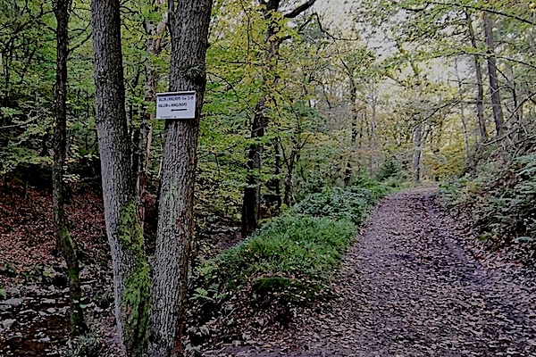
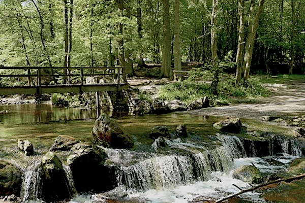
Jalhay is located at the gateway to the Nature Reserve Hautes Fagnes and has countless possibilities for walks in the Hertogen forest along the streams through splendid landscapes and exceptional nature, read more…
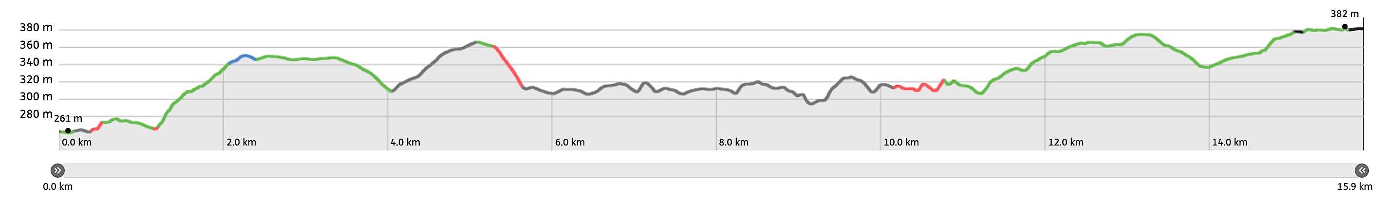
Overview map and stats:

| Start: | Eupen (BE) |
| Coordinates (DD): | 50.633030 / 6.043431 |
| End: | Jalhay (BE) |
| Coordinates (DD): | 50.558994 / 5.965489 |
| Distance: | 15,9 kilometers |
| Ascent: | 273 meters |
| Descent: | 151 meters |
| Elevation map: |
| Path, dirt road, nature trail: | 62% |
| Asphalt, road: | 38% |
| Pdf route map: | Go for download to page here |
| Gpx track: | Go for download to page here |
| KML file: | Go for download to page here |
- Pdf files are excellent for viewing.
- Gpx tracks can be uploaded to many devices, so you always know the direction to follow or your position.
- KML files can be uploaded in Google Earth. As result you get a detailed satellite view. You can even follow a videotour, which is a linear walk-through the stage.
Some highlights:
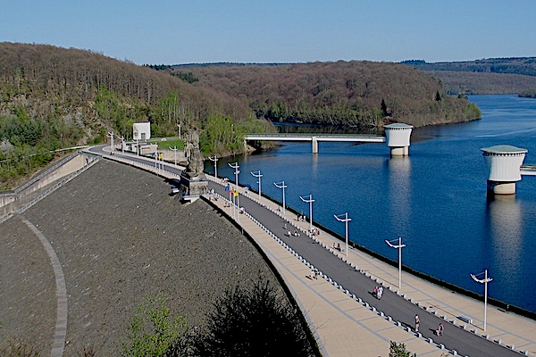
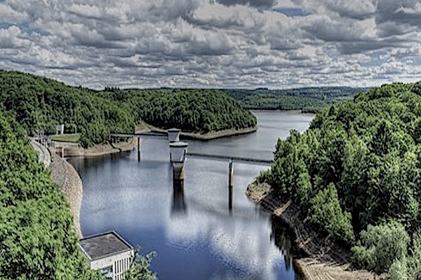
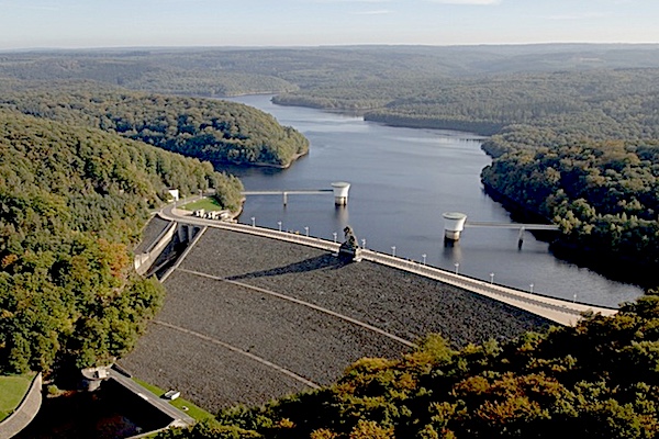
The Gileppe Dam (French: Barrage de la Gileppe) is located in the municipality of Jalhay. The supply of water is ensured by the Nature Reserve Hautes Fagnes. The original wall was the oldest concrete dam wall in Europe. The complex was officially opened by King Leopold II of Belgium on July 28, 1878, read more...
Specific local info:
Sleep suggestions:
Interesting websites:
