Stage 28. Hockai (BE) to Signal de Botrange (BE)
Stage 28. Hockai (BE) to Signal de Botrange (BE)
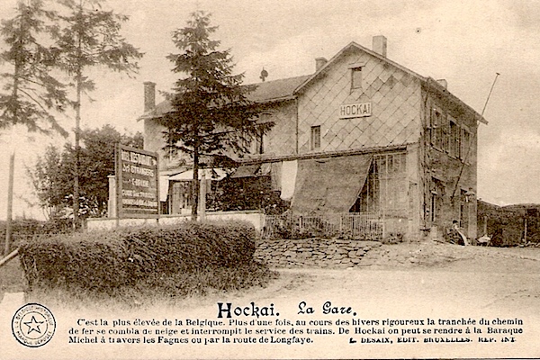
On an altitude of 555 meters Hockai is one of the highest villages of Belgium and situated in the far north of the municipality of Stavelot in the province of Liège, read more…
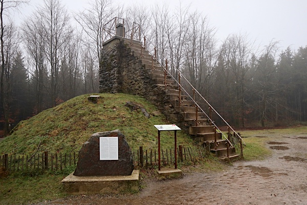
And once you arrive at Signal de Botrange try to climb the Baltia hill/monument, by climbing these stairs you can even reach above 700 meters. At that moment you are at the highest point in Belgium. An excellent opportunity to take picture: you are even on the top of the Benelux!
Although Signal de Botrange is not a state border, it marks a language border between the Roman languages (south and west) and Germanic languages (north and east).
Overview map and stats:
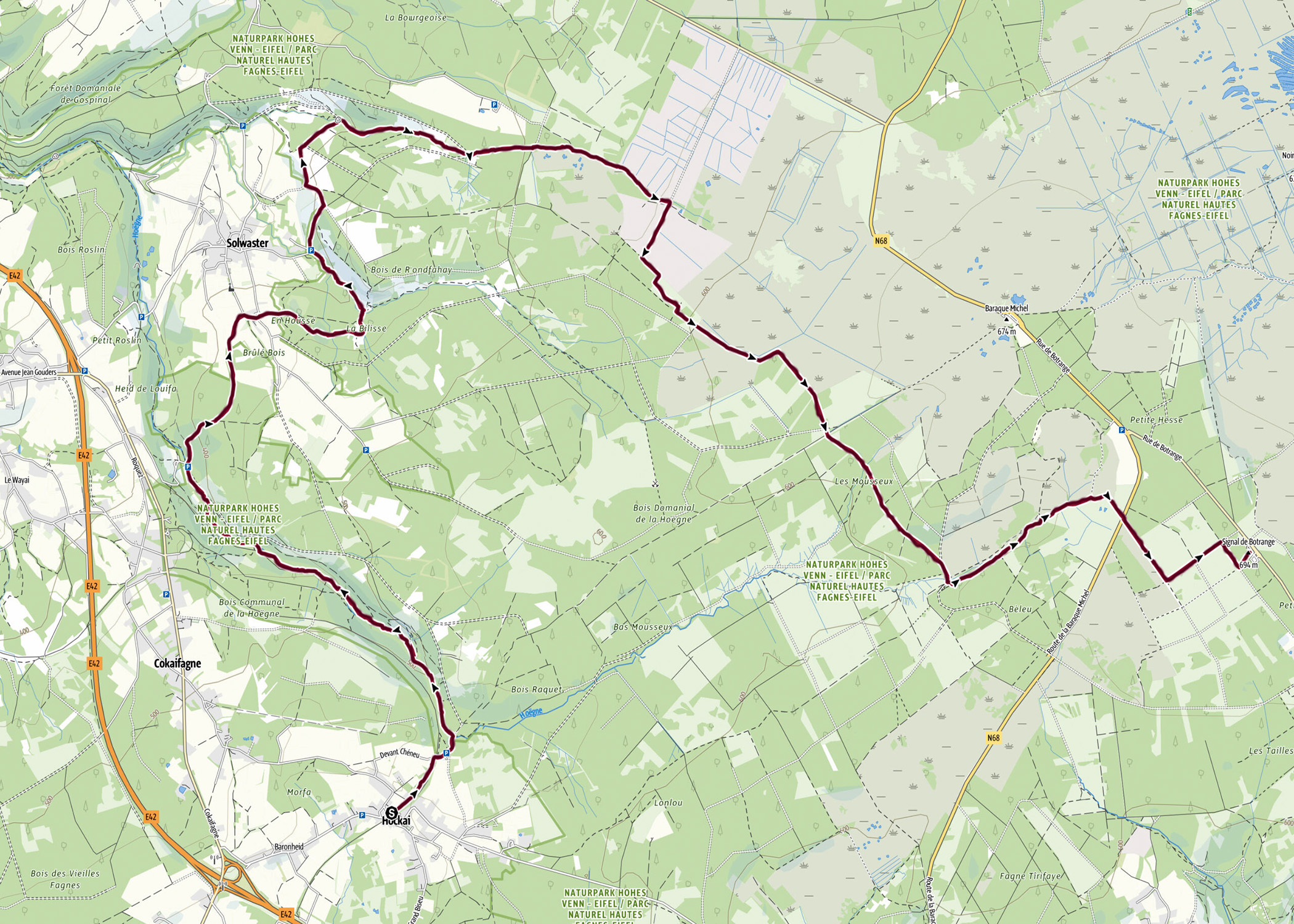
| Start: | Hockai (BE) |
| Coordinates (DD): | 50.481993 / 5.986158 |
| End: | Signal de Botrange (BE) |
| Coordinates (DD): | 50.50235 / 6.09297 |
| Distance: | 21,1 kilometers |
| Ascent: | 460 meters |
| Descent: | 316 meters |
| Elevation map: |
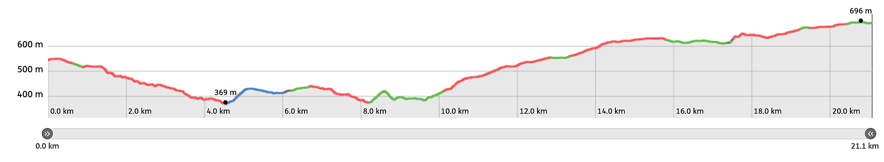
| Path, dirt road, nature trail: | 99% |
| Asphalt, road: | 1% |
| Pdf route map: | Go for download to page here |
| Gpx track: | Go for download to page here |
| KML file: | Go for download to page here |
- Pdf files are excellent for viewing.
- Gpx tracks can be uploaded to many devices, so you know the direction to follow or always your position.
- KML files can be uploaded in Google Earth. As result you get a detailed satellite view. You can even follow a videotour, which is a linear walk-through the stage.
Some highlights:

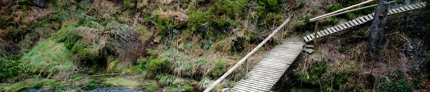
Pont du Centenaire (Bridge of 100 years) refers to 1930; the year in which the Kingdom of Belgium celebrated its 100th anniversary. In the past, the bridge was also called Le Pont de la Vecquée. The name Vecquée comes from the French word évêque which means bishop and refers to the prince-bishops of Liège who used this bridge to go to the abbeys of Stavelot and Malmedy, read more…
Specific local info:
Sleep suggestions:
Interesting websites: