Stage 31. Hellental (DE) to Monschau (DE)
Stage 31. Hellental (DE) to Monschau (DE)
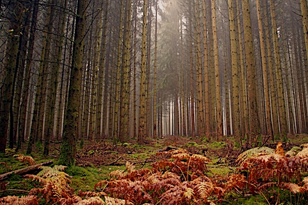
Hellenthal has 8000 inhabitants and the mostsouthern municipalty of Nordrhein-Westfalen and consists as much as of villages. Hellenthal is located on the edge of the Eifel National Park and the Oleftalsperre is one of the largest reservoirs in Germany. The reservoir contains about twenty million cubic meters of water and is fed by the river Olef.
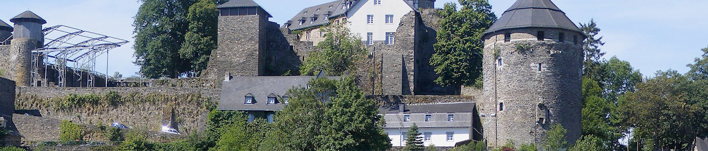
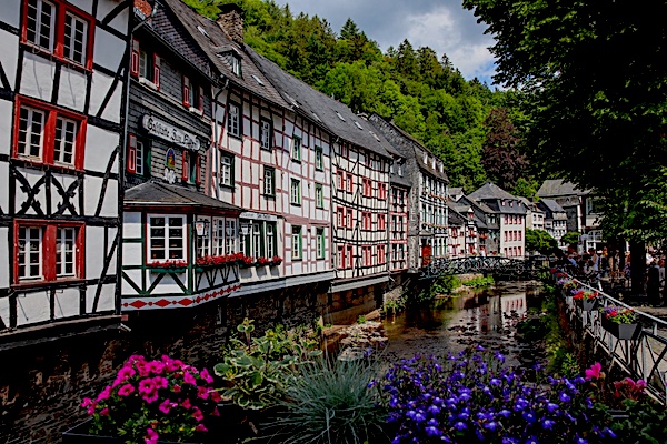
In the north of the Eifel, not far from the border with Belgium, Monschau is located in one of the most beautiful regions of Germany; the Eifel.
Monschau was first mentioned in 1198 as Mons Ioci. The castle probably originated from the 13th century and was founded by the Duke of Limburg as Castrum in Munioie. In 1352 the place received city rights. So Monschau is an old city whose history goes a long way back, read more...
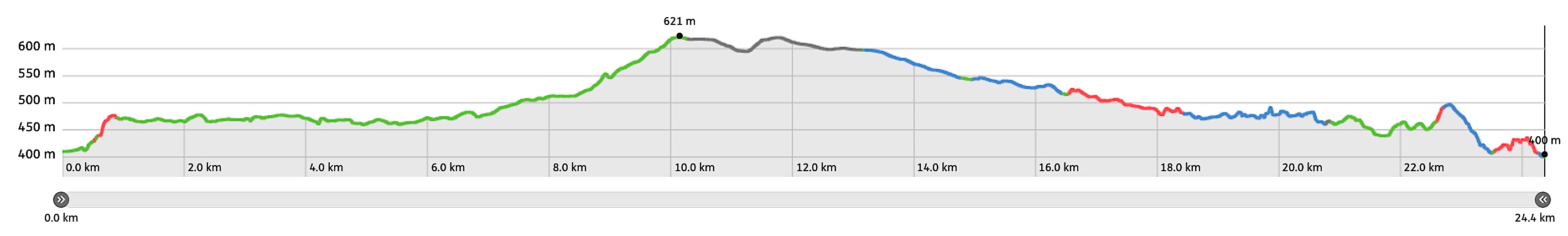
Overview map and stats:
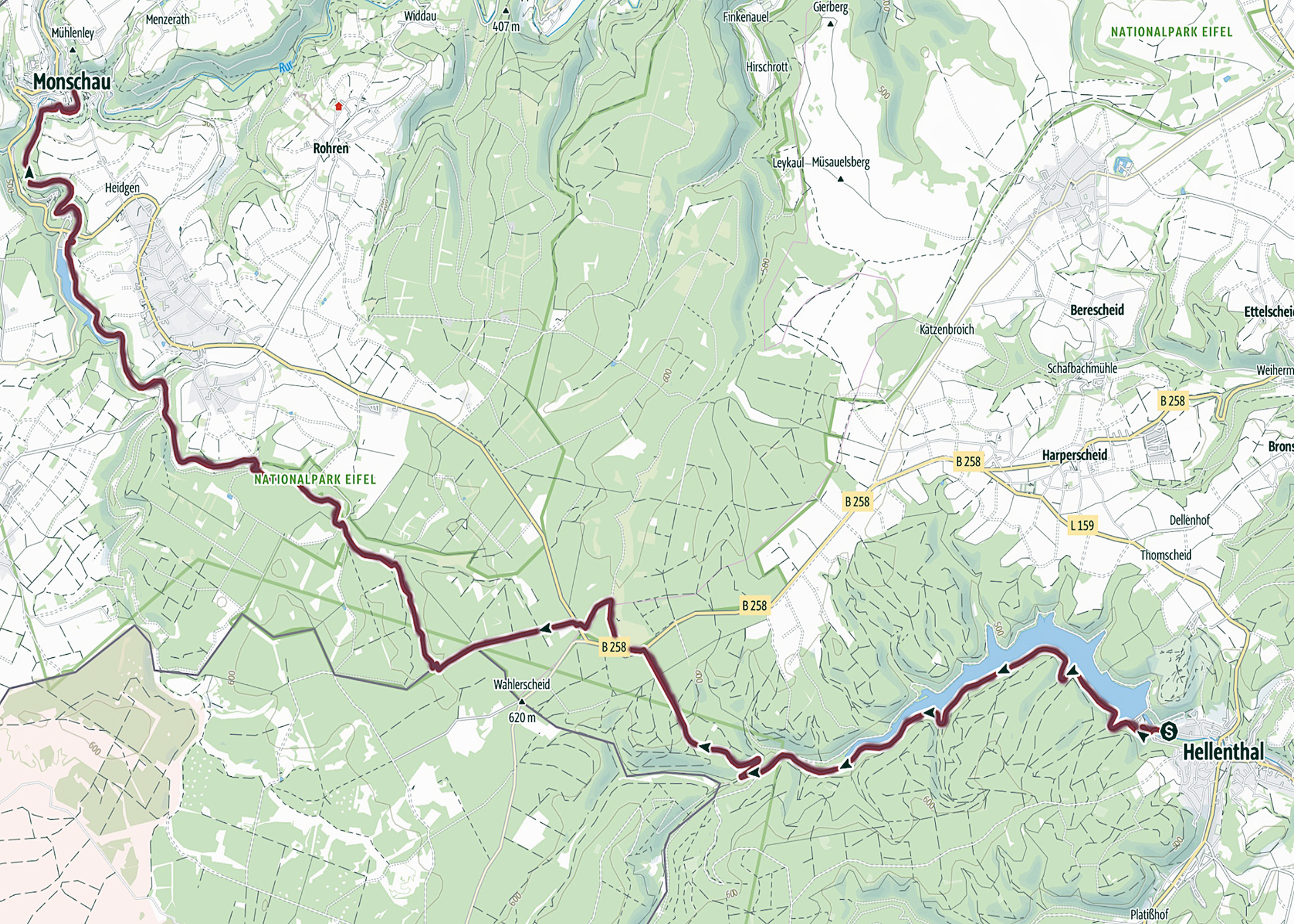
| Start: | Hellental (DE) |
| Coordinates (DD): | 50.491701 / 6.434909 |
| End: | Monschau (DE) |
| Coordinates (DD): | 50.491837 / 6.441756 |
| Distance: | 24,4 kilometers |
| Ascent: | 269 meters |
| Descent: | 293 meters |
| Elevation map: |
| Path, dirt road, nature trail: | 88% |
| Asphalt, road: | 12% |
| Pdf route map: | Go for download to page here |
| Gpx track: | Go for download to page here |
| KML file: | Go for download to page here |
- Pdf files are excellent for viewing.
- Gpx tracks can be uploaded to many devices, so you always know the direction to follow or your position.
- KML files can be uploaded in Google Earth. As result you get a detailed satellite view. You can even follow a videotour, which is a linear walk-through the stage.
Some highlights:
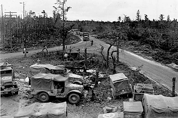
On December 13, 1944, the battle for the forest area and the strategic crossroads of Wahlerscheid started from Rocherath. The Allied forces ran up against strong fortresses, minefields and barbed wire barriers. The German forces reacted with heavy shellfire. Snowfall and a bad connection prevented the American advance, read more…
Specific local info:
Sleep suggestions:
Interesting websites:
