Stage 5. Übach-Palenberg (DE) to Jabeek (NL))
Stage 5. Übach-Palenberg (DE) to Jabeek (NL)
Übach-Palenberg is located approx. 20 km north of Aachen/Aix-la-Chapelle on the frontier with the Netherlands. Cultural and club life as well as recreation are very important in Übach-Palenberg, read more…
Jabeek is a small residential area in the municipality of Beekdaelen in Dutch Limburg. The name is probably derived from the stream Quabeek that runs through the village. Jabeek has about 705 inhabitants, read more…
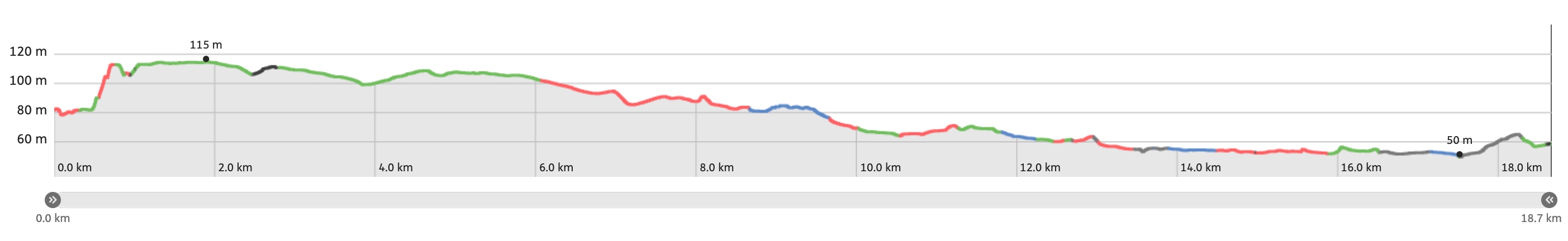
Trail map and stats:

| Start: | Übach-Palenberg (DE) |
| Coordinates (DD): | 50.919725 / 6.118786 |
| End: | Jabeek (NL) |
| Coordinates (DD): | 50.981919 / 5.941016 |
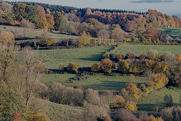
| Distance: | 18,7 kilometers |
| Ascent: | 57 meters |
| Descent: | 79 meters |
| Elevation map: |
| Path, dirt road, nature trail: | 87% |
| Asphalt, road: | 13% |
| Pdf route map: | Go for download to page here |
| Gpx track: | Go for download to page here |
| KML file: | Go for download to page here |
- Pdf files are excellent for viewing.
- Gpx tracks can be uploaded to many devices, so you always know the direction to follow or your position.
- KML files can be uploaded in Google Earth. As result you get a detailed satellite view. You can even follow a videotour, which is a linear walk-through the stage.
Some highlights:


NATO Air Base Geilenkirchen is located in Germany and six kilometers west of the town of Geilenkirchen. The base is known to the local population as Flugplatz Teveren. Surrounded by farmland and a natural woodland reserve the base was originally built by the Royal Air Force after World War II and operated as RAF Geilenkirchen. Flying operations at Geilenkirchen ended in January 1968 and the installation was handed over to the German Air Force in March 1968. Following by a NATO’s decision to establish NATO Airborne Early Warning & Control Force.
Specific info:
Sleep suggestions:
Interesting websites:
