Stage 39. Aachen (DE) to Epen (NL)
Stage 39. Aachen (DE) to Epen (NL)
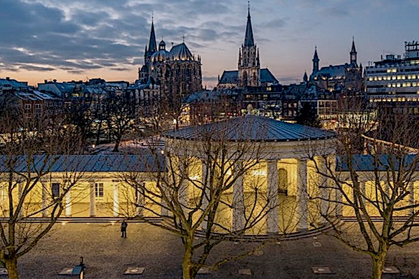
The ancient name of Aachen/Aix-la-Chapelle is not been passed. Since Charlemagne founded his castle on the remains of Roman baths, the Latin word aqua for water can be taken as the origin of the name.
The name Epen is probably derived from a Germanic word of possibly Celtic origin, “apa”, a word meaning “water”. The area was colonized in Roman times. Legionnaires who had served their time were assigned a plot of land. From this the later large Roman farms would arise: the villas, several of which have been excavated, read more…
Overview map and stats:

| Start: | Aachen (DE) |
| Coordinates (DD): | 50.776254 / 6.083398 |
| End: | Epen (NL) |
| Coordinates (DD): | 50.773320 / 5.914025 |
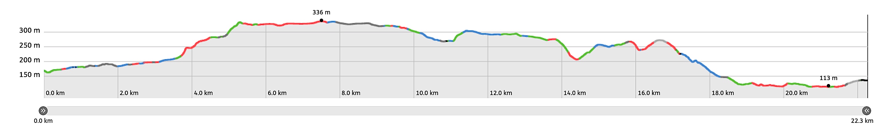
| Distance: | 22,3 kilometers |
| Ascent: | 326 meters |
| Descent: | 361 meters |
| Elevation map: |
| Path, dirt road, nature trail: | 82% |
| Asphalt, road: | 18% |
| Pdf route map: | Go for download to page here |
| Gpx track: | Go for download to page here |
| KML file: | Go for download to page here |
- Pdf files are excellent for viewing.
- Gpx tracks can be uploaded to many devices, so you always know the direction to follow or your position.
- KML files can be uploaded in Google Earth. As result you get a detailed satellite view. You can even follow a videotour, which is a linear walk-through the stage.
Some highlights:
Around Vijlen no fewer than 26 water sources flow over a distance of less than 5 kilometers and there are a multitude of water sources that spontaneously surface here, read more…
Specific local info:
Sleep suggestions:
Interesting websites: