Stage 36. Simonskall (DE) to Breinig (DE)

Stage 36. Simonskall (DE) to Breinig (DE)
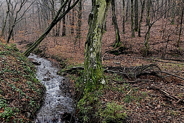
Simonskall started as a small settlement with the presence of iron ore, especially around the village Schmidt, hydropower from the stream Kall a tributary of the river Rur and charcoal from the surrounding forests made Simonskall one of the most important industrial settlements in the Monschau country.
Ore was mined in Breinig as early as Roman times in primitive smelting plants. And a Roman road from northern France via Belgium to Cologne touched Breinig.
Mining brought Breinig a modest prosperity. At times up to 700 ore workers worked in the area of the Schlangenberg (now a nature reserve), read more…
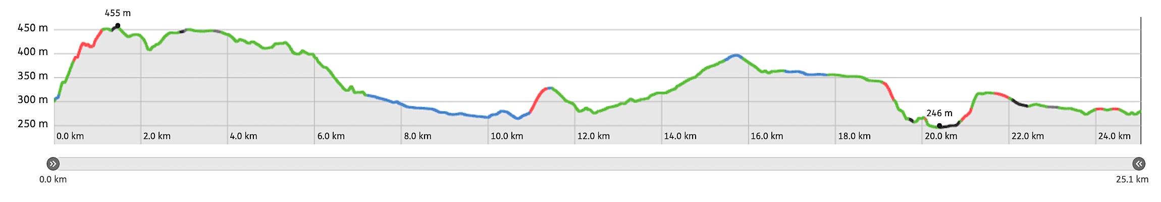
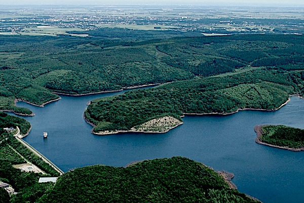
Overview map and stats:
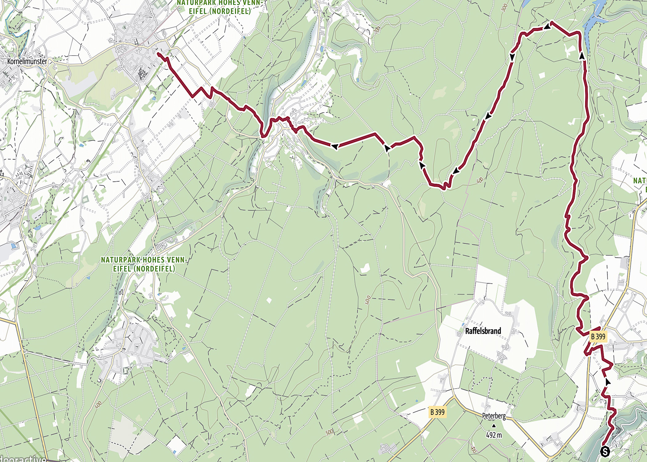
| Start: | Simonskall (DE) |
| Coordinates (DD): | 50.666152 / 6.351446 |
| End: | Breinig (DE) |
| Coordinates (DD): | 50.729983 / 6.220672 |
| Distance: | 25,1 kilometers |
| Ascent: | 477 meters |
| Descent: | 488 meters |
| Elevation map: |
| Path, dirt road, nature trail: | 93% |
| Asphalt, road: | 7% |
| Pdf route map: | Go for download to page here |
| Gpx track: | Go for download to page here |
| KML files: | Go for download to page here |
- Pdf files are excellent for viewing.
- Gpx tracks can be uploaded to many devices, so you always know the direction to follow or your position.
- KML files can be uploaded in Google Earth. As result you get a detailed satellite view. You can even follow a videotour, which is a linear walk-through the stage.
Some highlights:
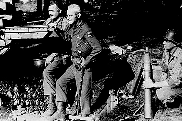
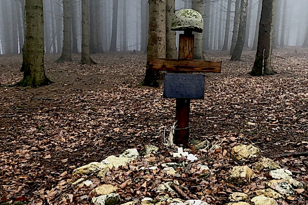
The Hürtgenwald (forest) was the last obstacle standing between US forces and the Rhine River. Yet the decision to advance into the thick forest in September 1944 proved to be a fatal mistake, read more…
Specific local info:
Sleep suggestions:
Interesting websites:
