Stage 7. Born (NL) to Opglabeek (BE)
Stage 7. Born (NL) to Opglabeek (BE)
The first mention of the place name Born dates from the year 1125. The settlement Born arose on the northeast side of the Graetbos (forest) near a water source. Born is located along the Juliana canal and in the so-called “waist of Limburg“, a narrow part of the Netherlands that connects South Limburg with the rest of the country, read more…
In the Middle Ages Opglabbeek lived from agriculture and turf extraction. At the end of the eighteenth century, Opglabbeek is visible on geographical maps as a small village on the edge of the moor, read more…
Trail map and stats:

| Start: | Born (NL) |
| Coordinates (DD): | 51.031997 / 5.812019 |
| End: | Opglabeek (NL) |
| Coordinates (DD): | 51.043789 / 5.583648 |
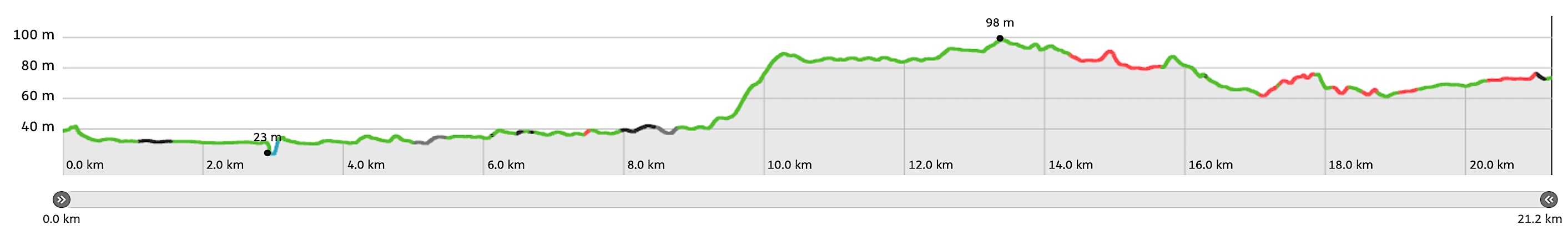
| Distance: | 21,2 kilometers |
| Ascent: | 104 meters |
| Descent: | 65 meters |
| Elevation map: |
| Path, dirt road, nature trail: | 90% |
| Asphalt, road: | 10% |
| Pdf route map: | Go for download to page here |
| Gpx track: | Go for download to page here |
| KML file: | Go for download to page here |
- Pdf files are excellent for viewing.
- Gpx tracks can be uploaded to many devices, so you always know the direction to follow or your position.
- KML files can be uploaded in Google Earth. As result you get a detailed satellite view. You can even follow a videotour, which is a linear walk-through the stage.
Some highlights:

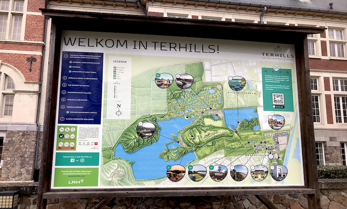
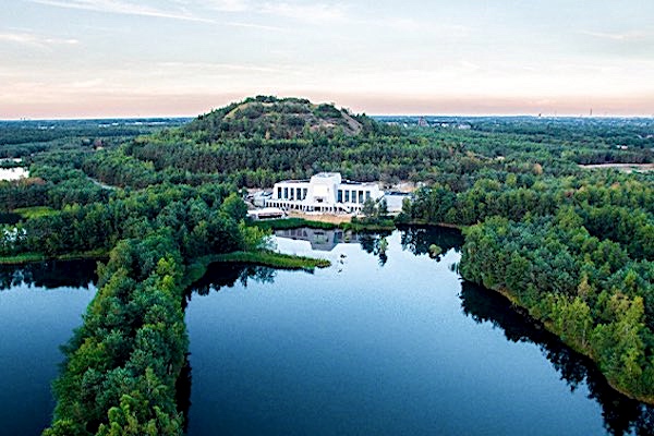
Where 30 years ago the coal mines were running at full speed you can now enjoy a surprising landscape of “mountains and lakes” and high peaks with spectacular panoramas! Until recently this area was known as Connecterra, but from the end of January 2021 the name changed to Terrils, but the splendor of this area remains unchanged, read more…